


chapelle du bois vert a laye station

Bernard Rodriguez
User

Length
12.1 km

Max alt
1471 m

Uphill gradient
418 m
Km-Effort
17.7 km

Min alt
1154 m

Downhill gradient
420 m
Boucle
Yes
Creation date :
2025-08-14 08:39:26.73
Updated on :
2025-08-14 13:05:02.286
4h25
Difficulty : Medium

FREE GPS app for hiking
 SityTrail
IGN / Geographical institutes
SityTrail Plus
The world is yours!
About
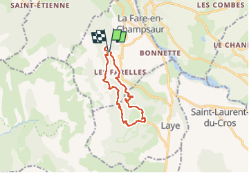
Trail Walking of 12.1 km to be discovered at Provence-Alpes-Côte d'Azur, Hautes-Alpes, La Fare-en-Champsaur. This trail is proposed by Bernard Rodriguez.
Positioning
Country:
France
Region :
Provence-Alpes-Côte d'Azur
Department/Province :
Hautes-Alpes
Municipality :
La Fare-en-Champsaur
Location:
Unknown
Start:(Dec)
Start:(UTM)
266596 ; 4950179 (32T) N.
Comments